Australia’s extreme locations
Visiting Australia’s extreme locations
To assist modern adventurers to experience the geographical extremes of Australia, we have compiled a list of locations and some notes on the best ways to get to these points of interest. Help us by sending in your photos to show other travellers the beauty of these spots.
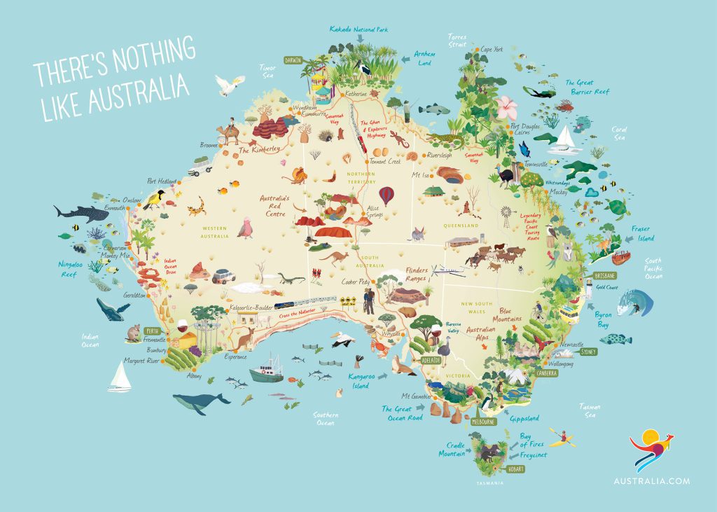
Locations of Extremes in Australia
Scroll in on map to see Places of Extremes in Australia
State
Bramble Cay – Australia’s Northern-most point. This is a difficult place to experience. The best bet to visit this infrequent trod point is to contact the council representatives or traditional owners on Darnley Island (Erub) to find out when their irregular visits occur and the possibility of assisting in their endeavours to get there.
Cape York – Continental Australia’s Northern-most point. While still over 1000 kilometres from Cairns by road, this highly sought after point, is popular with Australian travellers. If you haven’t your own 4WD expedition vehicle, join a tour with knowledgeable guides departing Cairns.
Cape Grenville – Longest Parabolic dunes in Australia. Cape Grenville is a little-visited location but the rewards are fabulous for the intrepid adventurer. Perched lakes, huge white dunes that go on forever and a glorious windswept beach. Make sure you have Hema Maps on board. Access through Bramwell Station
Cape Flattery – Second longest parabolic dunes in Australia. Great beach camping awaits the intrepid 4WD’er to this location. Excellent beachcombing, perched lakes, excellent flora in the dune swales. Access off Battlecamp road. Bring Hema Maps.
Thornton Peak – The furthest point from the centre of the earth in Australia. Big two to three day hike to the top of mountain. No water on the climb but the track crosses water at the top and bottom of the mountain. Contact National Parks for Permit and precise route to the trailhead.
Bellenden Ker – The wettest locality in Australia. The easiest route follows the cablecar pylons to the top station. The walk is one to two days hike. Best bet is to contact local bushwalking clubs to join their infrequent hikes to the summit. Permits required from National Park and Broadcast Australia if you wish to see the weather station.
Walshes Pyramid – Highest free-standing mountain in Australia. The trailhead is off Moss Access Road, just across the Mulgrave River bridge. The two-hour hike up is on a well-formed and marked trail. No water on the trail. There is still a race up the mountain every year, made famous by the Midnight Oil song ‘King of the Mountain’.
Babinda – Wettest Town in Australia. Beautiful little town on the Bruce Highway, 45 minutes south of Cairns. Golden Gumboot can be seen perched in the window of Post Office. Rain gauge poorly sited at the rear of post office compromised by high buildings.
Innot Hot Springs – Second Hottest Springs in Australia. On Kennedy Highway, two hours west of Cairns. A walk through Nettle creek in barefoot will expose hidden hot spring oozing through the sands. The pile of rocks at the rear of the hotel, covers the major spring source. Great place to make a base to explore the area.
Undara – Largest Lava tubes and longest lava run in Australia. Three hours west of Cairns on the Kennedy Highway. Great tours from the Undara lodge to view lava tubes. You can also view Undara Volcanic Crater by car through the National Park for free.
Tallaroo Hot Springs – Hottest springs in Australia. Four hours west of Cairns on Kennedy Highway then Gulf Development Road. The turnoff is on the right, just before Einsleigh River.
Wallaman Falls – Highest Single Drop waterfall in Australia. Ninety minutes north of Townsville. Take the turnoff at Ingham and follow signs up Abergowie Road and Stone River Road. Great camping area at the top of the falls. Watch out for colonies of jumping ants. Track down to falls takes an hour and take your swimmers.
White Blow at Ravenswood – Largest exposed quartz formation in Australia. Turn west at United service station, just north of Burdekin River bridge on Bruce Highway. Follow road for 1.5 hours along the Burdekin River to White Blow.
Mitchells Junction – Junction where water can either flow to the Pacific Ocean, Lake Eyre or Gulf of Carpentaria.
Finch Hatton – Revised largest single day’s rainfall. Fifty minutes west of Mackay on the Mackay Eungella Road to Finch Hatton. In Finch Hatton turn left into Zahmel Street and look for the old post office which is now a private residence at No.7 Zahmel Street.
Kennedy’s Junction – Junction where water can choose to flow to the Pacific Ocean, Southern Ocean, or Lake Eyre. The location is on Callenvale Station out of Tambo. Contact station managers for directions.
Back Creek Bore – First artesian bore sunk in Queensland. Thirty-eight kilometres east of Barcaldine on the Capricoronia Highway. Good camping just off the roadside and next to the old dam.
Cape Hillsborough – Start of the longest continental hotspot chain of volcanoes. Thirty minutes north of Mackay on Bruce Highway, turn right just past the Leap Hotel and follow signs out to Cape Hillsborough. Pass Pinnacle Rock on the way through to the beach. Excellent geology along the foreshore of the beach.
Clairview – Northern End of the tropic of Capricorn line
Styx River Tidal Bore – One of the largest tidal bores in Australia. Ninety minutes north of Rockhampton, take the second Ogden turnoff. The easiest place to see the tidal bore is from the bridge before the town, five hours after the high tide peak.
Baffle Creek- Southern end of Tropic of Capricorn
Fraser Island – Largest Sand Island in the World. Ferries from Harvey Bay or Inskip Point,
Lake Boomanjin – Largest permanent perched lake. The track to this lake isn’t as frequented as the Lake Mackenzie track
Mount Tempest – Largest sand dune in Australia. Ferries from Brisbane River (Pinkemba) and Redcliffe take passengers and vehicles to Moreton Island. Great camping all over the island. The walk up mount tempest is relatively easy but due to lack of shade, best attempted in early mornings or late afternoons.
Crohamhurst – Largest single day rainfall. One hour north of Brisbane. From Peachester, take Bald Knob road then Crohamhurst Rd. Jones homestead is on track at top of hill past Cemetery Rd. Heritage-listed Crohamhurst Observatory was built many years after the event further along Crohamhurst Rd.
Mount Superbus – Head of Australia’s longest river. 1 hour from Brisbane. From Boonah find Carney Creek Rd which turns into Spring Ck Rd. Follow until you surmount the range and on the right is Brett Rd. A three-hour walk takes you to the summit. The Lincoln aircraft crash site is just off the track, but well marked.
Simpson Desert – Longest parallel sand dunes. Many access points but most accessible is via Birdsville, 2000 km west of Brisbane. Conventional vehicles will take you to Big Red at the edge of the desert
Big Red – Largest desert sand dune. Access through Birdsville.
Elizabeth Springs – Second-largest mound springs complex. 300 km south of Mount Isa. Entrance via Springvale Rd. Make sure you have Hema Maps on Board.
Mount Isa – Most polluted postcode in Australia – 2000 km from Brisbane. Hard to access the sulphur dioxide grounds without MIM approval.
Mount Warning – First sunlight to strike continental Australia for the majority of the year. There are a plethora of road signs pointing to Mount Warning from Murwillumbah. The eight-kilometre return hike from the carpark is relatively easy on a well graded track but steep with no water. Take headtorch for early predawn walk.
Bald Rock – Large Granite batholith. Access from Tenterfield on Mount Lindsay Rd. National Park fees apply. Easy walking with great views.
Cape Byron – Eastern-most point in continental Australia. Avoid peak times during holidays as carpark get very full. Scenic walks with excellent views out to sea. Eastern-most point is a group of rocks below last lookout along the cliff, not at the tip of Cape Byron.
Brumlow Top – Highest volcano on continental Australia.
Jenolan Caves – Oldest cave system in Australia. Three hours west of Sydney. Well worth the overnight stay. walks around Blue Lake is good for Platypus. Get cave tours in early or late to avoid bus loads of Sydney visitors.
Yarrongobilly Caves – Oldest Cave system in Australia. Four Hours south of Sydney. Access via Snowy Mountains Highway from either Cooma or Gundagai. Last six kilometres is unsuitable for caravans. Snow on roads during winter months.
Mount Kosciuszko – Highest mountain on continental Australia. Trail head begins at top of chairlift from Thredbo or from Charlotte Pass. Easy half days hike. Look for foot print of old meteorological hut established by Clement Wragge just off summit.
Blue Lake – Largest glacial circque on continental Australia. This is a ten kilometre return hike from Charlotte Pass, through snow gums and alpine tundra. Good views from lookout over Blue Lake and wetland is a RAMSAR site.
Charlotte Pass – Coldest temperature in Australia. Five hours from Sydney. From Jindabyne take Kociuszko Road to Perisher and onto Charlotte Pass. Road from perished closed during winter months. The meteorological station has been removed from site at the back of the Chalet Hotel.
Cadell Fault Line – One of continental Australia’s longest fault lines. Three hours north of Melbourne. Fault line starts near Rochester and continues through to Deniliquin. Best seen from the Cobb Highway near Mathoura. Access to Barmah State Forest and Murray River National Park from Mathoura.
Kiama Blowhole – Largest Australian blowhole. Two hours south of Sydney. The major Blowhole is sitated next to the lighthouse on Blowhole point. The smaller Little Blowhole is two kilometres south on Tingirra Avenue. Best time to witness this phenomena is during a large south-easterly swell.
Mount Imlay – First sunlight in Australia, January 1. half hour drive from Eden off Princess Highway. Turn left into Burrawang Rd. Walk starts from Burrawang picnic area. 6 kilometre return hike on rough track. Views are superb from on top.
Lord Howe Island – Tallest sea cliff. Two hour flight from Sydney of Brisbane. Track to summit of Mount Gower is a full day trek with incredible views. Best to take a guide to interpret the endemic species.
Balls Pyramid – Tallest Sea stack. Four hour boat tours depart Lord Howe Island. Impossible to land on Balls Pyramid these days but well worth the experience.
Bass Canyon – Largest submarine canyon in Australia. Fishing charters out of Lakes Entrance are expensive but maybe rewarding for the fishing enthusiast.
South Point – Southern-most point of continental Australia. Three-hour drive to Tidal River from Melbourne. The closest car park is at Telegraph Saddle. Thirty-four kilometres hike to South point, of which twenty-six kilometres is on a dirt road. Best bet is to take a mountain bike for the road section, otherwise, this is a two-day hike.
Cornthwaite Tree – The alleged tallest tree in Australia. Two hours from Melbourne at Thorpedale. Follow MacDonald’s Track and on the right (eastern side) of the road is a small sign erected by Jim Balfour a couple of decades ago.
Lake Corangamite – Largest permanent hypersaline lake. Two hours west of Melbourne on the Princes Highway. Turn right onto Corangamite Rd and left onto Lineens Rd. Foreshore Reserve provides easy access to the lake.
Lake Beeac – Most hypersaline lake in Australia. Before Colac on the Princes Highway, turn right onto Colac Bathurst road. Numerous access points onto the lake.
Lake Werowrap – Most alkaline lake in Australia – Following Lake Corangamite Road, turn left onto Red Rock Reserve Road. Lookouts from the hilltop, take in the usually dry lake below.
Lake Purrumbete – Largest volcanic maar. Two and a half hours west of Melbourne along the Prince’s Highway. Turn right at Hawkes Nest Road or Narlangil Road. Many access points. Great views along the northern shoreline.
Lake Bullen Merri – Large double volcanic maar. Two hours west of Melbourne on Prince’s Highway. Turn left at Leura Street in Camperdown, turn right into Naroghiod Road. Follow signs to Bullen Merri Recreation Reserve.
Lake Tyrell – Hyper-acidic lake. Five hours north-west of Melbourne. Follow Calder Highway to Robinvale Sealake Road. Turn left into Pier Millan Chinkapook Road. Follow signs to wetland reserves.
Cape Grim – Claim to be the cleanest air in the world. Three hours west of Launceston along Bass Highway. Turn right onto West Montagu Rd and follow until the end of road. Special permission is needed to enter the Van Diemens Land Company property and the Cape Grim Weather station.
Mount Read – Oldest trees in Australia. Three Hours west of Launceston. Follow Bass Highway to Burnie. Turn left onto Ridgley Highway. Follow through to Tullah and Roseberry. Turn left at Roseberry to Williamford Road and then Mount Read Road. look for signs to Lake Johnson Nature Resrve. Boardwalk on left to stand of Antarctic beech.
Cape Sorrel wave rider bouy – Largest wave in Australia. Cape Sorrel at the entrance to Macquarie Harbour is the closest point to the waverider bouy. Access here is only by private charter boat. The best option is to drive to Macquarie Heads or Henty Dunes to experience the incoming swells.
Junee Caves – Deepest and coldest caves in Australia. One and a half hours west of Hobart. Take the road to New Norfolk, Westerway and the Maydena. Turn Right onto Junee Road at Maydena. A great walk to the cave entrance with a river coming out of the side of the hill.
Lake St Clair – Deepest Lake in Australia. Two hours north-west of Hobart. Follow Lyell Highway to Derwent Bridge and turn right into Lake St Clair Road. Good walks around the sand dunes and you can join the boat to do the hiker pickup across the lake.
Centurion Tree – Tallest tree in Australia. One and a half hours south-west of Hobart on Huon Highway. Turn Right at Geeveston onto Arve Road. Best to stay at a local retreat to get the best directions and advice on protecting tree from you bringing in diseases.
Kermandie Queen – Largest Tree in Australia. One and a half hours south-west of Hobart on Huon Highway. Turn Right at Geeveston onto Kermandie River Road. 700 metres past river crossing look for signs on left to track.
South East Cape – Cleanest air in Australia, most southerly point of the island of Tasmania. Two hours south of Hobart on Huon Highway. Park at Boltons Green Campsite. Full day trek. Well formed track the South Cape Bay. Track to South-east Cape is overgrown but a few walking blogs point the way there. Honey Smith Hill where the cleanest air was measured overlooks South East Cape
Cape Pillar. – Sea Cliffs
Cape Hauy – Sea Stacks. Just over an hour from Hobart along Tasman Highway. Turn left past Lavender farm into Fortescue Road. Walking trail starts at car park at end of road. 4 hour return walk.
Ships Stern Bluff – Biggest breaking waves in Australia. Just over an hour and a half from Hobart along Tasman Highway and onto Nubeena Road. Turn left onto Stormlea Road and follow to Cape Raoul Carpark. Walk trail for 1.5 kilometres before taking right hand fork to Ships Stern’s. Track divides further along for beach or bluff viewing.
Tasman Arch – Largest sea arch in Australia. One Hour from Hobart. Easy viewing from Carpark off Blow Hole Rd and Tasman Arch road. Best to take a boat journey to take in the full spectacle of Tasman Arch. Cruises leave from Pirate Bay.
Macquarie Island – Highest Mountain, most southerly point, biggest earthquakes, only place to see oceanic crust. Expedition cruise ships is about the only way to bet to Macca. Most leave from New Zealand and take in the New Zealand sub-Antarctic Islands as well.
Mount Gambier – Deepest volcanic maar and most recent volcanic eruption in Australia. Four and a half hours from Adeaide via Tailem Bend, Keith and Naracoorte. Interpretation centre just off highway in town. Tours to pump station leave there regularly.
Mount Schank – Most recent volcanic eruption in Australia. Ten minutes from Mount Gambier on the Riddock Highway. Turn left onto Post Office Road and left again onto Trevor Clarke Drive. Trail head is at the Carpark at the the road. 600 metres to crater rim or a 2.7 kilometre round circuit trail.
Lake Frome – Brighest spot on earth (highest alcedo). Seven hours north of Adelaide, through Port Augusta, Hawker and the Flinders Ranges National Park to Ballacoona Station. the only public access is via Ballacoona Creek track to lake edge. Take Hema Maps with you.
Lake Eyre – Largest lake, Deepest point, largest endorheic lake. Nine hours north of Adelaide. Lake Eyre South is visible off Oodnadatta Track. look for ancient stromatolite heads in salt crust. Lake Erye North is best viewed from Halligan Bay Track, just seven kilometres south of William Creek.
Lake Acraman – Largest Meteorite crater in Australia. Ten hours from Adelaide. Best route is through the Gawler Ranges to Mt Ive Station and onto Lake Acraman. Private property and permission needed. Ejecta site can be found on Bunyeroo Road in the Flinders Ranges.
Mount Wudinna – Large Monolith. Six Hours west of Adelaide on the National Highway. Turn right at Australian Farmer scuplture and follow signs.
Maralinga – Site of the largest plutonium pollution in Australia. Bookings essentials to get to Maralinga village and join tours. Thirteen hours from Adelaide along Eyre Highway, turn right twenty-seven kilometres west of Nundroo. There is no sign pointing to Maralinga here. Follow the track to Iluke Mine where directional signage starts about eighty kilometres from Eyre Highway.
Nullabor – Largest peneplain in Australia. one of the largest limestone beds in the world. Along the Eyre Highway. Multiple tracks take you to the Bunda Cliffs overlooking the Great Australian Bight.
Gawler Ranges – Largest ancient supervolcano in Australia. Seven hours west of Adelaide on Eyre Highway. Turn right at Minnipa onto Yardea Road. Turn left onto Scrubby Campground Road once inside the park. Organ Pipes are the best relic of this supervolcano.
Oodnadatta – Hottest location in Australia. Eleven Hours north of Adelaide. Follow Stuart Highway to Coober Pedy and turn right onto Kempe Road. In Oodnadatta, turn left into Angara Street before the Pink Roadhouse. The abandoned Meteorological station is on the left before the airport.
Dalhousie Springs – Largest mound springs in Australia. Fourteen hours north of Adelaide. Fifteen kilometres north of Oodnadatta, turn right onto Mount Dare Road. Follow signs to Dalhousie Hot Springs. Take Hema Maps.
Marla Gravity warp – Largest gravity warp in the world. Eleven hours north of Adelaide on Stuart Highway.
Kanowana – Driest locality in Australia. Private property. Need permission from Clifton Hills Station first. Access via Strzelecki Track via Moomba or Birdsville Track via Mungerannie. Hema Maps is essential.
Great Victoria Desert – Largest Australian desert. Ten hours east of Perth. Go through Kalgoorlie to Mount Monger Road which leads you to the Trans Acess Road following the path of the Indian Pacific Railway.
Cocklebiddy Caves – Longest cave dive in the world. Twelve hours east of Perth. Follow the highway through Hyden and Norseman onto Eyre Highway. The unmarked turnoff is eleven kilometres on left east of Cocklebiddy Roadhouse. Continue for ten kilometres to cave entrance. The cave is closed to the public but access to doline entrance is open.
Bilbunya Dunes – Largest mobile coastal sand dunes. Largest star dunes. Twelve hours east of Perth via Israelite Bay. Follow Telegraph track from Israelite Bay. Beware of beach driving, wet sand and seaweed get very soft. Tough track over Wylie Scarp on the eastern side to get to Eyre Highway at Balladonia.
Lake Hillier – Pinkest lake in Australia. Esperance is seven hours east of Perth. Best photos are from scenic flights from here. Cruise boats leave Esperance to Middle Island and a short walk to Lake Hillier
Lake Chidnup – Most Alkaline Lake. Five hours east of Perth, just above Raventhorpe. Follow the road through Wickepin, Newdegate and Lake King to Lake Chidnup. Mostly surrounded by private property but lake visible from road and area where tankers fill up for alkaline water.
Toolibin Lake – Largest perched lake in Australia. 2.5 hours southeast of Perth just past Wickepin. Turn right at signpost twenty kilometres along Wickepin Harrismith Road. Series of tracks allows you to drive the site when the lake is dry.
Nornalup Inlet – Smallest tidal variation in Australia. 4.5 hours south of Perth along South Western Highway. You can view Nornalup inlet from Coalmine Beach Road but your best bet is to join Gary Muir’s WOW Wilderness cruises. Highly recommended.
Cable Beach Tsunami Rock – Tsunami rock. 4.5 hours south of Perth along Albany Highway. Follow Frenchmans Bay Road into National Park and turn right into The Gap Road and find carpark for cable Beach on left. A multitude of steps leads onto the beach.
Dalgaranga Crater – Smallest Meteorite crater in Australia. Seven hours north of Perth along Midlands road. Travel through Marawa and onto Yalgoo. Take Yalgoo North Road and Dalgaranga Mount Magnet Road for 100 kilometres and turn left onto Dalgaranga Meteorite Crater Road. Signposted fifteen kilometres from junction.
Yarrabubba Crater – Oldest Meteorite structure known. Nine hours north of Perth on Great Northern Highway to Meekathara. The Geophysical anomaly is 1 hour (seventy kilometres) south of Meekatharra on Meekatharra Sandstone Road.
Woodleigh Crater – Largest impact structure in Australia. Woodleigh is eight hours north of Perth on the North West Coast highway west of Hamelin pool. Nothing remains on the surface here, the impact structure is entirely buried.
Erawondoo Hill / Jack Hills – Oldest rocks in the world. 10.5 hours north of Perth via Mullewa and Murchison. Newly listed as a National Heritage site. You definitely need Hema Maps for this site.
Mount Augustus – Large monolith. Fourteen hours north of Perth. The best two access roads come from Carnarvon (430 Kilometres) and Meekatharra (340 kilometres). Good tracks around the mountain with some decent rock art.
Hamelin Pool – The largest concentration of Stromatolites. Eight hours north of Perth on the North West Coastal Highway. Turn left onto Shark Bay Road at Overlander Roadhouse and right at the sign to Hamelin Pool.
Steep Point – Western-most point of continental Australia. Ten Hours north of Perth. Take Shark Bay Road from the NW Coastal Highway, then Useless Loop Rd then follow the signs. Let your tyres down before the Carrarang Sand Dune.
Zuydorp Cliffs – Long sea cliff. The cliffs start at Kalbarri, six hours north of Perth and extend to Pepper Point just south of Steep Point and at the very start of the Carrarang Sand Blow. Best access is from the NW Coastal Highway with numerous access points.
Montebello Islands – Site of the largest atomic test in Australia. The only way to access these Islands is by boat. Charters leave from both Onslow and Karratha, about fifteen hours north of Perth. limit your radiation exposure on Trimouille Island to one hour per day
Marble Bar – Hottest town records. Sixteen hours north of Perth. Original temperatures were recorded behind old council building which is now the Tourism information centre.
Strelley Pool formation – Oldest life on Earth. Sixty kilometres south on Marble Bar towards Nullagine, turn right onto the track and follow for one kilometre to carpark. Stromatolites are in the first gully to the west.
King Sound Tides – Fast tidal race. Two and a half hours north of Broome on the Cape Leveque Road brings you to Cygnet Bay. Boat tours from the Oyster farm take you out to the tidal race. Look at the tide table to ensure the tidal variation is large and attempt to go mid-tide.
Horizontal Falls – Fastest Tidal Race. One hour flights leave both Broome and Derby. Best experienced by water through the tidal race.
Raft Point – Largest tidal variation. This point is accessible on an expedition cruise boat. Tours run throughout the dry season from Darwin and Broome
Wyndham – Hottest Town. Thirty-two hours from Perth or nine hours from Darwin. Go through Kununurra and continue straight at Cockburn Rest Area. Original met station was at the port, then behind the current post office and now at the airport.
Lake Argyle – Darkest alcedo in Australia. One hour south of Kununurra towards Northern Territory border. Turn right at Lake Argyle Road and follow to lake.
Wolfe Creek Crater – Perfectly formed meteorite crater. Two hours south of Halls Creek. The turnoff to the Tanami Track is ten kilometres south of Halls Creek and follow for approx 100 kilometres until you see the signs for Crater.
Bullita Caves – Longest caves system in Australia. These are located in Judbarra Gregory National Park, six hours from Darwin and less than an hour from Timber Creek. Follow the Bullita access Road toward the homestead for thirty-nine kilometres and turn right towards Limestone Gorge. The caves are closed for cultural reasons but great walks to experience immense stromatolite fossils on top of the gorge.
Victoria River Tidal bore – Longest tidal bore in Australia. Timber creek is six hours from Darwin and the best place to experience the Victoria River. The biggest tidal bore travels upstream on the large tides in April and May.
Melville Island- Second largest Australian Island. A thirty minute scenic flight will get you there or catch the ferry to Wurrumiyanga on Bathurst Island and get someone to ferry you across the narrow strait.
Gosse Bluff – Large comet impact site. Two hours from Alice Springs along Larapinta Drive. Follow the well marked signs. Great walks within the site but best views are from Tylers Pass Lookout
Finke River – Oldest landscape on Earth. Less than two hours from Alice Springs following Larapinta Drive. Turn left just after Hermannsberg onto Finke River Road towards Palm Valley. Very soft sand in places 4WD only. Best views are from Kalarranga Lookout.
Papunya – Furthest town from the sea in Australia. Three hours north-west of Alice Springs. Head north on the start Highway, turn left on the tanami Track and left again onto Kintore Rd.
Uluru – Largest monolith. Five hours south west of Alice Springs. Take Stuart Highway south and turn right just after Erldunda Roadhouse. Follow Lassiter’s Highway until you see a big red rock.