GEOGRAPHIC EXTREMES SOCIETY
AUSTRALIAN RECORDS
The Centres of Australia
Officially, there is no ordained actual ‘centre of Australia’ although many have tried to affix this label to several locations. Working with an irregular coastline on the surface of a round globe makes this task more complicated, but mapping the geographical centre of Australia can be achieved via various methods.
There are eight recognised ways of defining the Geographical Centre of Australia
- Linear Median Point
- Geodetic Median Point
- Early explorers Centre of the continent
- Madigan’s Centre
- Centre of Gravity
- Lambert Centre
- Johnson’s Geodic Centre
- Furthest from the Sea
All these points have at one time or another been considered as the Centre of Australia.
Linear Median Centre.
Location. 24° 54′ 50.508″S, 133° 23′ 45.9594″E. Palmer Valley Station. Twenty kilometres west of the Stuart Highway and forty kilometres directly east of Chambers Pillar
The median point takes the extremes of continental Australia’s latitude and longitude, at Cape Byron, Steep Point, Cape York, and South Point. The Linear Median Centre simply uses the middle of the extremes of longitude and latitude to find this point on Australia’s surface to the south of Alice Springs. There is no Marker on the site.
Geodetic Median Centre
23° 33′ 9.864″S, 133° 23′ 45.9954″E. Hamilton Downs Station. Four kilometres south of the Tanami Track
This Median Centre is currently in favour with Geoscience Australia, to represent Australia’s Median Centre which takes into account that the lines of longitude are wider towards the equator. One degree of longitude is 111 kilometres wide at the equator but only 85 kilometres wide at latitude 40 degrees south. The Geodetic Median Centre is on the same longitude as the Linear but 150km to the north. There is no Marker on the site.
Early Explorers Centre of Continent
Location 21° 55′ 21.4314″ S, 133° 28′ 39.6114″
The Central Mount Stuart location is a historical definition for what they determined the centre of Australia to be in the mid-nineteenth century. This location is best viewed from the Stuart Highway rest stop of the same name, just north of Ti Tree in central Australia. As the name suggests, it was first mapped by John McDouall Stuart in 1860, who initially named it Central Mount Sturt to honour Charles Sturt, who was the first to attempt to reach the centre of the continent. The method Stuart used to calculate the centre of the continent by using the median longitude between Steep Point and Cape Byron then measuring halfway along that meridian line between the coasts of South Australia and the Northern Territory. The site is marked with a cairn.

Stuart left this note in the Cairn which now rests in the State Library of South Australia.
Madigan Centre
Location – 25° 36′ 34.236″S, 134° 14′ 44.952″E. Lillia Creek Station. Eleven kilometres west of the Lambert Centre.

In 1933, the great Cecil Madigan attempted to find another of Australia’s centres, the Centre of Gravity for Australia. Madigan made a metal cut-out of Australia, making it slightly spherical to match how Australia would lie on a globe, then by use of a plum bob, found the point where it would balance on a pinhead. The position proved to be remarkably close, just 11 kilometres to the west, of the location most currently recognised as the centre of the continent, the Lambert Centre of Australia.
Unknown if there is a survey mark here
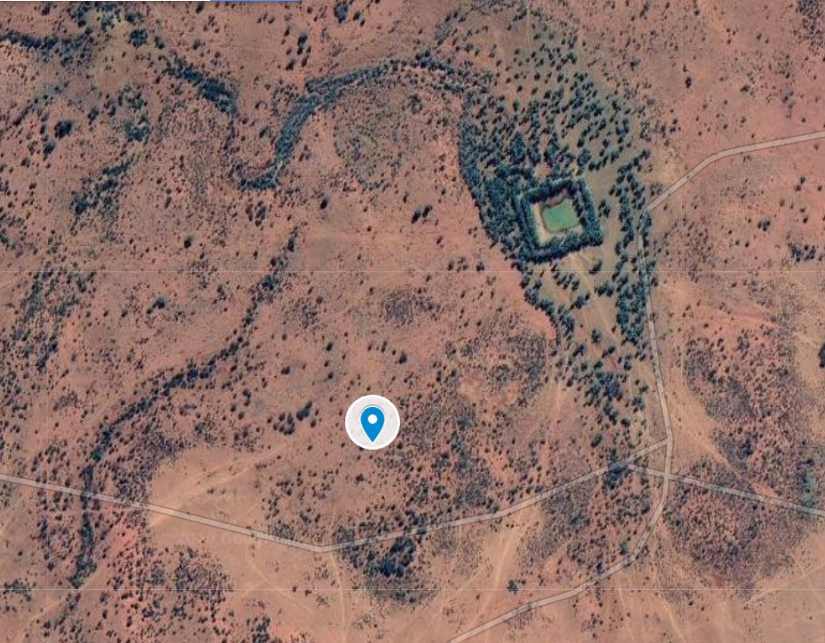
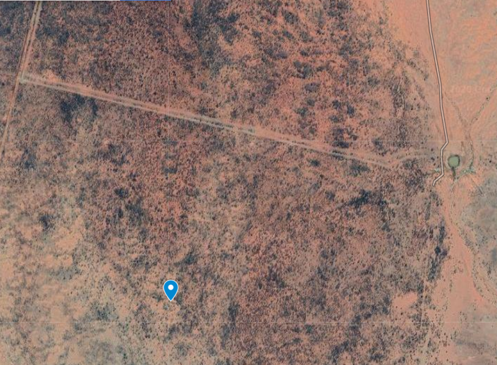
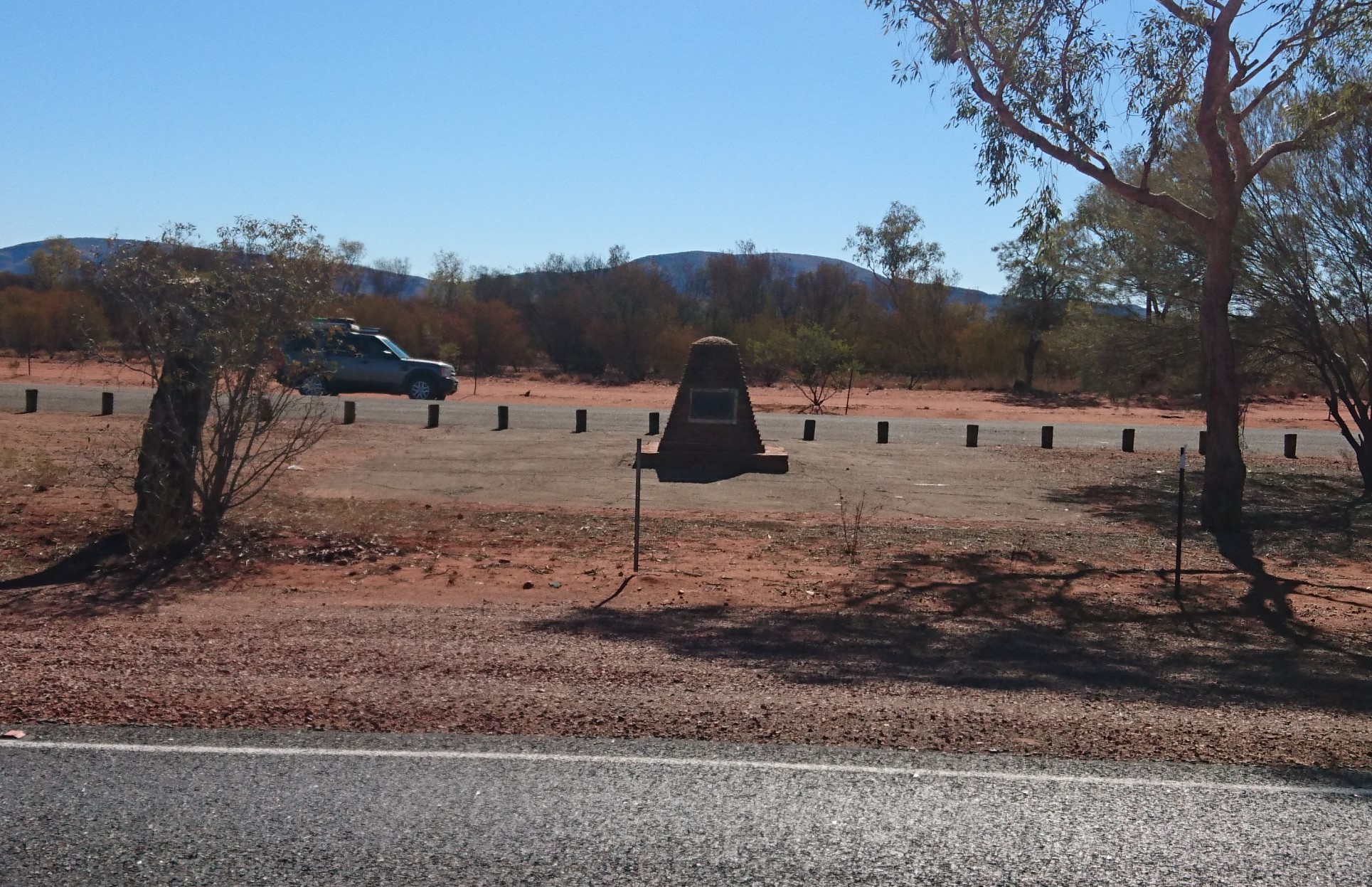
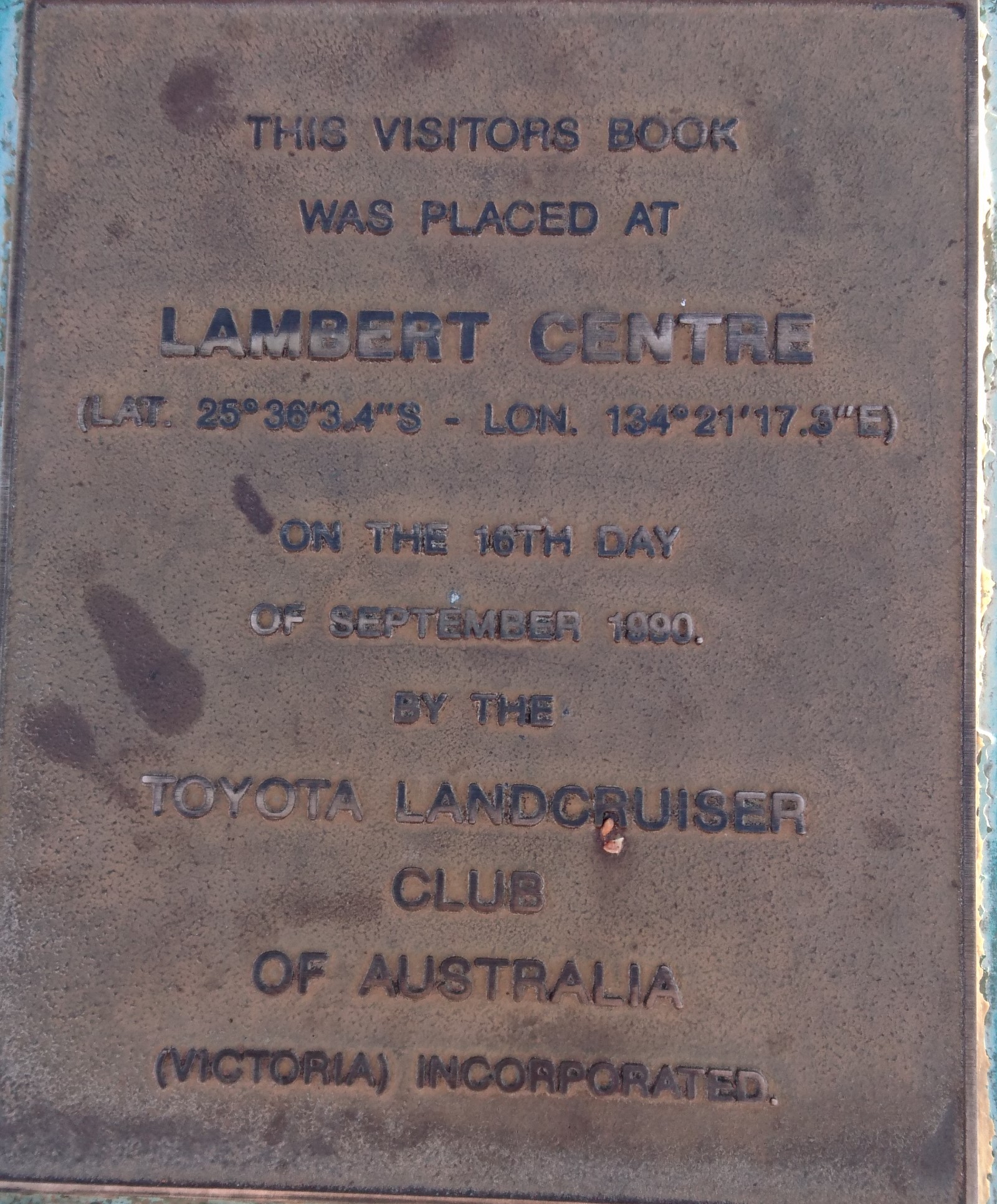
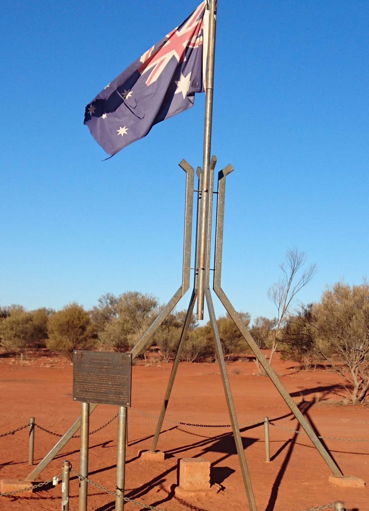
The Lambert Centre
Location – 25° 36′ 36.252″S, 134° 21′ 18.0354″E. Seven Kilomtres north of the Finke Rd. Note this is the permanent survey mark and not the Lambert Centre monument and flagpole which 600 metres to the east of the Permanent Survey Mark
For Australia’s bicentenary in 1988, the Queensland chapter of the Royal Geographical Society of Australasia decided to commemorate the 200th anniversary of European settlement by mapping what they determined to be the exact geographical centre of Australia. The Royal Geographical Society committee used 24,500 reference points around Australia’s coastline to perform some incredible mathematics before a Queensland Lands Department computer spat out the coordinates to a location 150 kilometres to the east of Kulgera on the Stuart Highway. The ‘Lambert Centre of Australia’ honours of the great Australian cartographer Dr Bruce Lambert, who was instrumental in defining Australian Antarctic Territory and who also contributed to the United Nations’ ability to determining borders and territories in this region.
The Lambert centre is now just another of the historic centres of Australia. With changes to mapping systems the same computations put the centre further to the north.
There is a flagpole monument 600 metres to the east of Lamberts Centre and a Permanent Survey Mark at the site.
Furthest Point from Sea
Location – 23° 02’S, 132° 10′ E – Derwent Station. Thirty Kilometres north of Papunya Road

This attempts to find the centre of the continent judged by distance from the coastline. There are a couple of terms geographers use for this: Furthest from the Sea, Tidal Centre, and the incredibly confusing and somewhat vague, Centre of Inaccessibility. They all pretty much mean the same thing, although the Tidal Centre takes into consideration the tidal movement up coastal rivers. In Australia, the Victoria River in the Northern Territory and the Gulf rivers of Queensland have the greatest influence on the Tidal Centre results. The nearby township of Papunya holds the title as the ‘Furthest Town from the Sea’. The site is marked with a simple plaque next to a station track

Centre of Gravity
Location – 23° 07′ S, 132° 08′ E. Derwent Station. Twenty kilometres north of the Papunya Rd and ten kilometres from the furthest point from the sea centre

Geoscience Australia has calculated the Centre of Gravity, using 50,000 points from Australia’s coastline. This point also lies within the boundaries of Derwent Station, and close to the position for Furthest from the Sea. No Marker found at site.
Johnsons Geodetic Centre
Location – 25° 56′ 49.3″ S, 133° 12′ 34.7″ E. Mount Cavenagh Station. Two kilometres east of Stuart Highway.

The last centre point was the most useful for cartographers. In 1966, a project to undertake a complete mapping survey of the Australian continent needed to establish a central reference point. It was determined that the reference point must be in central Australia, easy to access, and on a prominent hill. To this end, they found a location near the Stuart Highway just inside the Northern Territory border. The site is marked by a Trig Station marker on a prominent position on a hill overlooking the Stuart Highway.
Centres of States and Territories
The data here is supplied by Geoscience Australia and they have used the Geodetic Median Point method
Australian Capital Territory – 35° 29′ 24″ S, 149° 00′ 05″ E
New South Wales – 32° 09′ 48″ S, 147° 01′ 00″ E (1.5 km west of cairn)
Northern Territory – 19° 23′ 00″ S, 133° 21′ 28″ E
Queensland – 22° 29′ 13″ S, 144° 25′ 54″ E
South Australia – 30° 03′ 30″ S, 135° 45′ 48″ E
Tasmania – 42° 01′ 17″ S, 146° 35′ 36″ E
Victoria – 36° 51′ 15″ S, 144° 16′ 52″ E (Four kilometres south of the Cairn)
Western Australia – 25° 19′ 41″ S, 122° 17′ 54″ E
The Geographic Extremes Society welcomes any input as to the veracity of these records and we encourage everyone to contribute to these extreme records by contacting us to initiate the discussion