GEOGRAPHIC EXTREMES SOCIETY
AUSTRALIAN RECORDS
Australian Drainage Basins
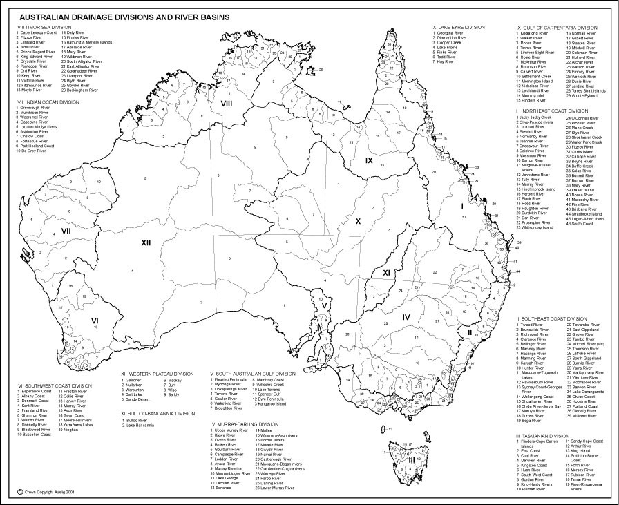
Australia has a multitude of river basin draining to three oceans, the remnants of an inland sea (Lake Eyre Basin) and others which drain to desert salt lakes. In the image of Australia’s Drainage basins below, what appears to be the largest drainage basin (XII) is the Western Deserts Plateau, an area defined by creeks and rivers whose rare flowing events result in the filling of claypans and salt lakes.

Australia’s Drainage Basins Image: Bureau of Meteorology
Largest Australian Drainage Basin
The largest of Australia’s drainage basins is the Lake Eyre Basin at 1,281,000 km2 followed by what most think as Australia’s largest basin the Murray Darling Basin at 1,061,000 km2.
The Largest East Coast Drainage Basin
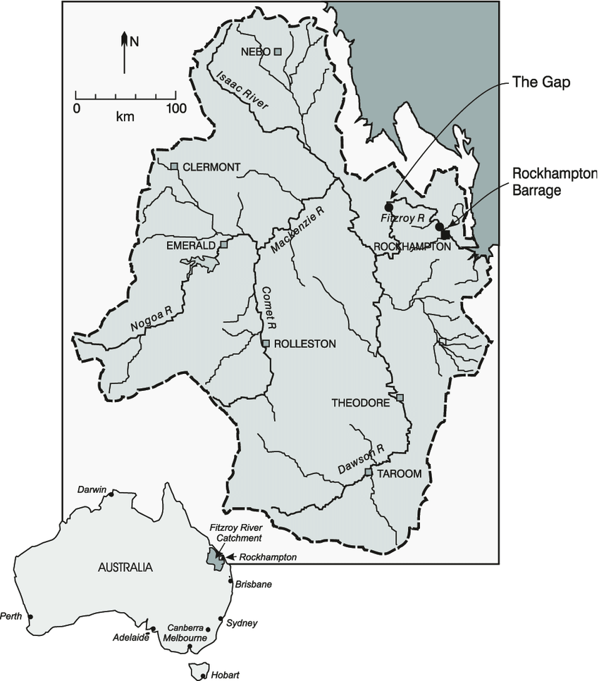
The largest east coast drainage basin is the Fitzroy River Basin at 142,665 km2 followed by the Burdekin River Basin at 129,700 km2.

Fitzroy River Basin. Largest East Coast Drainage Basin. Image: Bormans 2005
Greatest River Discharge
Many people claim that the Clarence River in New South Wales is the largest river on the east coast of Australia, however it’s small length and drainage Basin (22,850 km2) only make it the largest east coast drainage in that state. The greatest average discharge for East coast rivers is the Burdekin River at 380 m3/s followed by Fitzroy River at 187 m3/s. The Clarence River has a discharge of 160 m3/s.
Largest West Coast Drainage Basin
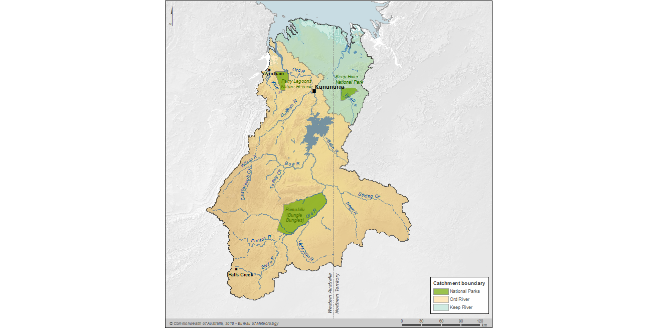
The largest West coast and Western Australian Drainage Basin is the Avon/Swan Drainage Basin at 125,000 km2. The greatest discharge for west coast rivers is the mighty Ord River at 123 m3/s.

Ord River Drainage Map. Largest West Coast River discharge. Image BoM.
Continental Drainage Divide Tripoints.
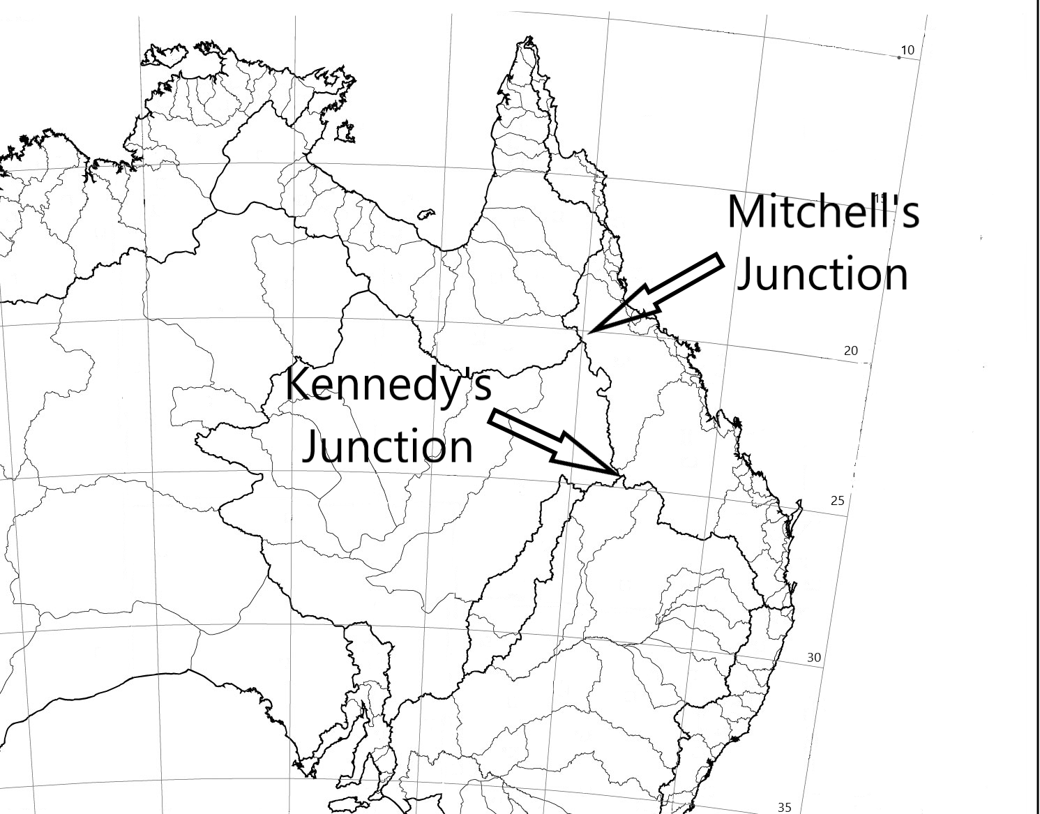
There are two prominent continental drainage divide tripoints in Australia.
They are Kennedy’s Junction and Mitchell’s Junction. The rain which falls at Kennedy Junction can choose to flow to one of three different paths:
- To the Pacific Ocean, via the Fitzroy River system;
- To the Southern Ocean, via the Murray-Darling system; or
- To Lake Eyre, via Barcoo River and Cooper Creek.
The rain which falls at Mitchell’s Junction can choose to flow to one of three different paths:
- To the Pacific Ocean, via the Burdekin River system;
- To the Indian Ocean, via the Flinders River system; or
- To Lake Eyre, via Thomson River and Cooper Creek.

Continental Drainage Divide Tripoints of Australia. Image: RJ Andrews
Australia’s Drainage Basin Records
GES Record: Largest Drainage Basin in Australia. Lake Eyre Basin – 1,281,000 km2 (Source: BoM)
GES Record: Largest East Coast drainage Basin- Fitzroy River – 142,544.7 km² (Source: BoM)
GES Record: Largest West Coast drainage Basin- Avon/Swan River – 125,000 km² (Source: BoM)
GES Record: Largest River Discharge on East Coast Burdekin River – 380m3/s (Source: Wikipedia)
The Geographic Extremes Society welcomes any input as to the veracity of these records and we encourage everyone to contribute to these extreme records by contacting us to initiate the discussion
